
Conspiracy Theories
A forested island on Williston Reservoir vanished, then drifted 30 km
What happened
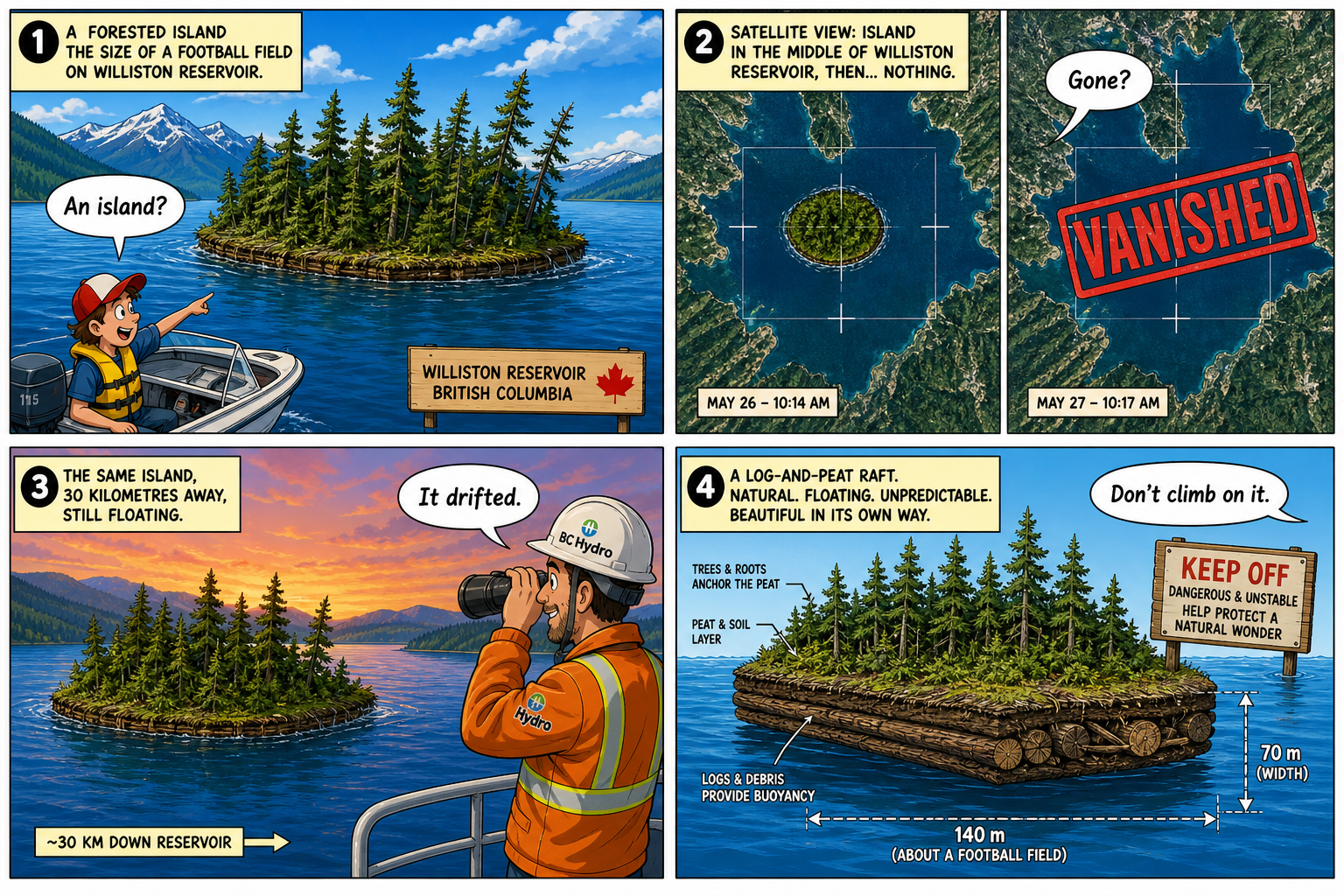
BBC News reports a forested patch on Williston Reservoir in British Columbia that looks like a tiny island and behaves like a raft. Locals spotted it in early August. Satellite images later showed it gone from that first pin. On Monday it turned up about 30 kilometers away, near Ospika. Measurements in the coverage put the mat at roughly 140 meters by 70 meters, trees and all. It is unexplained in the pop-history sense: a floating forest that clocks out of one grid square and checks into another. It is not a navy, not a portal, and not a story about anyone’s government. The source URL for this package is the BBC piece.
BC Hydro spokesperson Bob Gammer, quoted in the same reporting, describes a raft of driftwood and peat, the kind of mat that can form when reservoir water stays high. Williston has seen high water since 2012, he said. The advice is practical: do not climb on it. Peat and driftwood can come apart. The Globe, the Guardian, and CKPG ran parallel versions of the same raft. This desk is filing the BBC URL as the source of record, with the Hydro explanation in the last panel so the unexplained beat stays entertainment, not a lecture and not a coded fight. A reservoir this large can hide a 140-meter mat behind a headland and then reveal it on a new shore. That is still a fun satellite ghost.
The strip is the cute island, the X on the map, the 30 km hop, and a clipboard. Color on the water, the pines, the ranger hat. White gutters. Cartoon trees, not a documentary still. Conspiracy on this desk is pop unexplained and landscape oddities. A wandering forest on a Canadian reservoir is the right shape: weird, photographed, given a mundane peat-and-driftwood note, still visually uncanny. Readers can keep the mystery feeling and the don’t-climb warning in the same four panels.
Why it matters
This is not yesterday’s mini-Bigfoot and not a Syracuse pond figure. New water, new raft, new Monday pin. The entertainment value is the hop: gone from satellite, back 30 kilometers later, still a forest on a floating mat. The grounded value is Gammer’s peat-and-driftwood line and the high-water note since 2012. Both belong in the recap. Neither belongs in a speech about hidden builders. Don’t climb is the safety line, not a punchline that dares anyone onto the raft.
Unexplained packages die if they wander into politics or hate. This one does not. It stays on the reservoir, the 140-by-70 measurement, the early-August sighting, the Monday reappearance near Ospika, and the Hydro clipboard. That is the whole beat.
Conclusion
A treed raft about 140 by 70 meters left one Williston pin, vanished from satellite, and reappeared Monday some 30 km away near Ospika. Hydro says peat and driftwood in high water. Don’t climb. Source: https://www.bbc.com/news/articles/cgk5jk6nkxzo
Source: BBC News