
Conspiracy Theories
LiDAR finds Minanbé, a roadless Maya city hidden in Campeche jungle
What happened
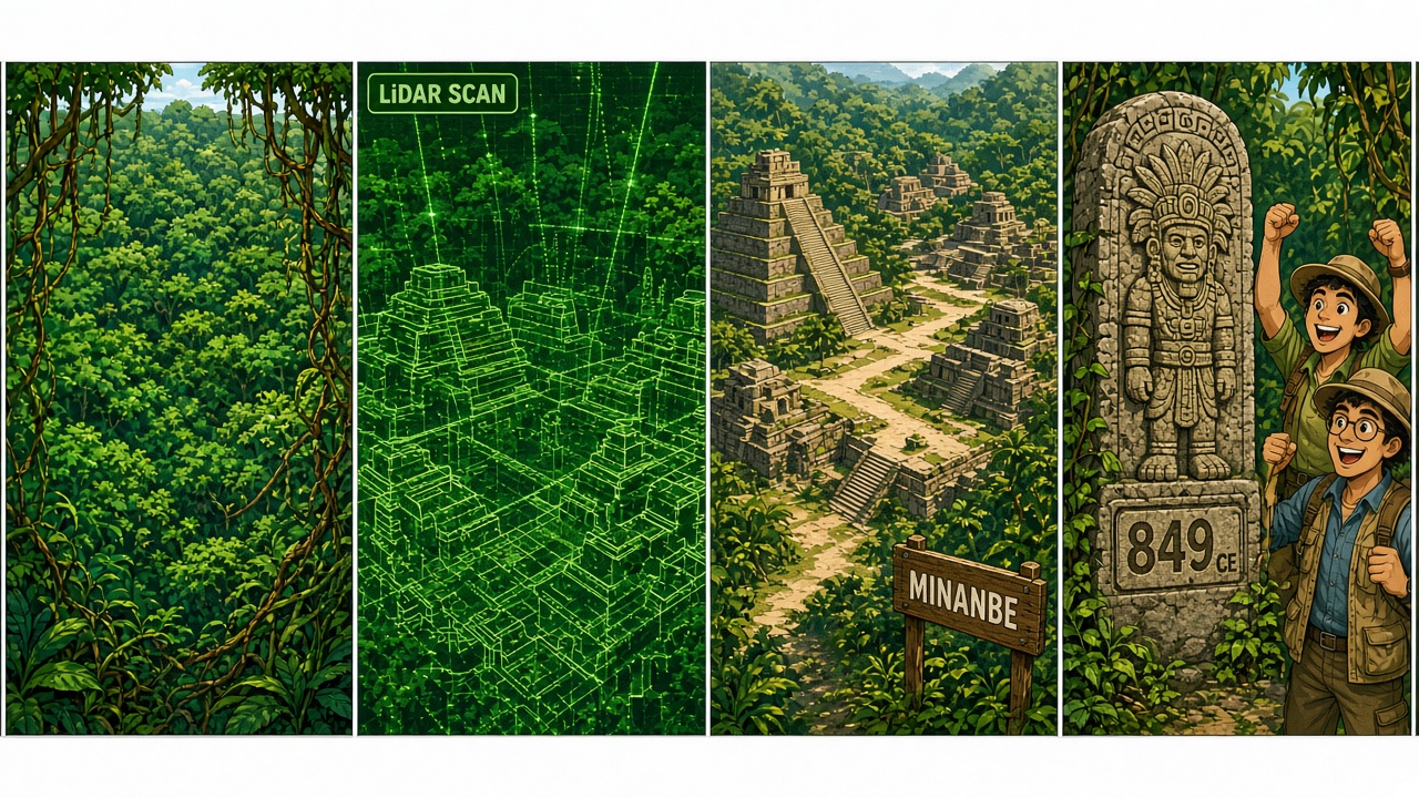
Smithsonian Magazine’s smart-news write-up of an INAH-backed expedition describes Minanbé — Yucatec Mayan for roughly “there is no road” — a previously unlooted Maya city found via aerial LiDAR inside Mexico’s Calakmul Biosphere Reserve in Campeche. Excavation leader Ivan Šprajc notes no old logging paths lead there; the team cleared miles of trail before walking kilometers of jungle. After a 2023 LiDAR scan of about 40 acres, ground crews mapped urban plazas, palaces, religious buildings, terraces, and water channels. That is the Conspiracy Theories desk in entertainment/archaeology mode: a hidden city in the canopy, not modern intrigue.
The tallest building is a Río Bec-style temple pyramid more than 40 feet tall. Researchers recorded 14 stelae and altars; epigrapher Octavio Esparza Olguín reads one stela with a date equivalent to 849 CE — near the Lowland Maya collapse window — and another altar with a late-seventh-century calendrical element as the oldest monument on site. Jungle greens and limestone gold, white gutters, cartoon diggers only. Pop-history / unexplained archaeology only — no politics-adjacent frames. Source: https://www.smithsonianmag.com/smart-news/deep-in-the-mexican-jungle-archaeologists-discovered-a-lost-maya-city-that-may-yield-clues-about-the-civilization-just-before-it-collapsed-180989030/.
Readers get the “no road” name, the LiDAR-to-machete workflow, the plaza-and-pyramid layout, the 14 monuments, and the 849 CE stela date — a Saturday unexplained-history comic without inventing lost empires.
Why it matters
LiDAR keeps rewriting the Maya map by showing cities where canopy hid plazas. A late-classic stela dated 849 CE is a concrete timeline peg for how urban life looked just before regional collapse narratives take over. Color on the scan grid and the pyramid. White gutters. Readers get the INAH/Smithsonian receipt, the Río Bec note, and the source URL on the page.
Conclusion
Aerial LiDAR and a hard jungle trek revealed Minanbé, a roadless Late Classic Maya city in Campeche with plazas, a Río Bec pyramid, and stelae including an 849 CE date — pop-history archaeology only, per Smithsonian Magazine. Source: https://www.smithsonianmag.com/smart-news/deep-in-the-mexican-jungle-archaeologists-discovered-a-lost-maya-city-that-may-yield-clues-about-the-civilization-just-before-it-collapsed-180989030/
Source: Smithsonian Magazine